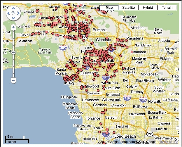
Have you been in disbelief over the state's plans to shut down hundreds of our lovely weed shops? If you've been living in denial, this will be a sobering, (please forgive the pun) visual for you to digest: a map denoting every marijuana dispensary in L.A. that was summoned by the city to close for business by June 7, each red dot representing one of the 439 shops whose days are numbered.
The map enables us to see exactly how the new ordinance to close these shops will affect the city's landscape. By the looks of it, Westwood Blvd between Pico and Sunset, and Melrose between Fairfax and Highland will no longer be amongst the go-to areas to pick up some fresh greenery come June.
The ordinance, and the map to illustrate it's impact, mark the end of an era when we could find a Cannabis Club just by driving down any given commercial street for a few blocks. Now everyone's going to have to put some effort and planning into getting a refill, instead of moseying their stony way around the corner expecting to stumble upon a weed shop. And we also lose bragging rights to our friends who live out of town about the availability of marijuana how it's as easy to get as stopping for gas at the station.


.jpg)
.jpg)


.jpg)
.jpg)
.jpg)


